360 kilometres (222 miles) of remote forest, bog, and mountains on the Canol Heritage Trail were ahead of us as we set out on the hike. We hit the trail August 1st, 2019 and finished hiking 22 days later in Norman Wells, NWT.
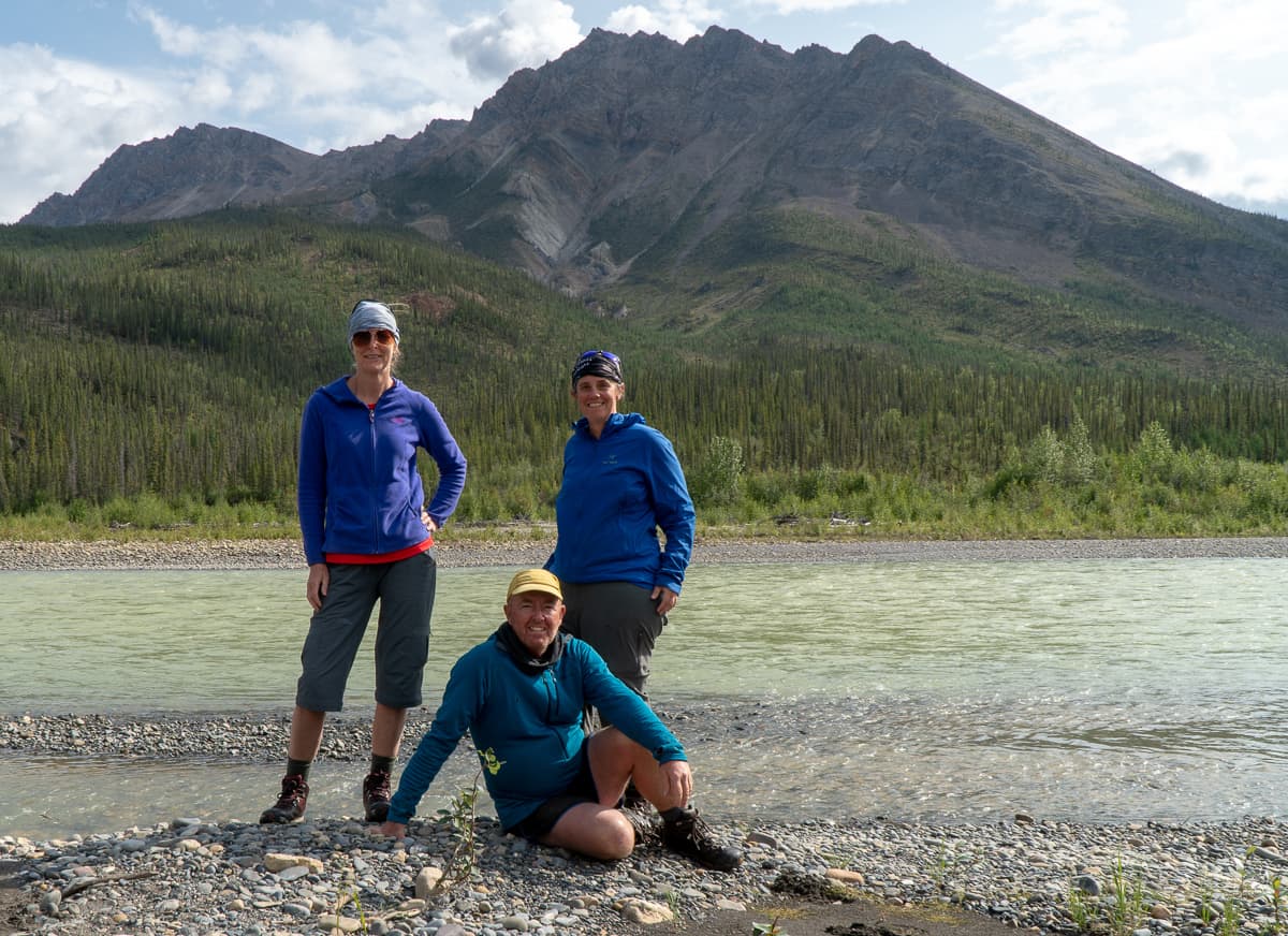
Matt and I were really excited to be joined by our friend Karyn on this adventure. It was just the three of us and any animals we encountered along the way.
About the Trail
The Canol Heritage Trail is a historic abandoned pipeline that runs through the Mackenzie Mountains in the Northwest Territories of Canada. Built during the second world war by the Americans to send oil from Norman Wells to the Alaska Highway, it was abandoned a year or so later.
Logistics
We had a lot of logistics to sort out for a trip of this magnitude, including what we would eat, and gear we would need specifically for this trip.
Getting To The Start & Home
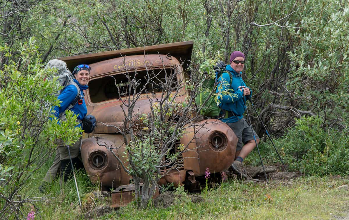
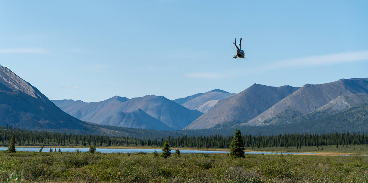
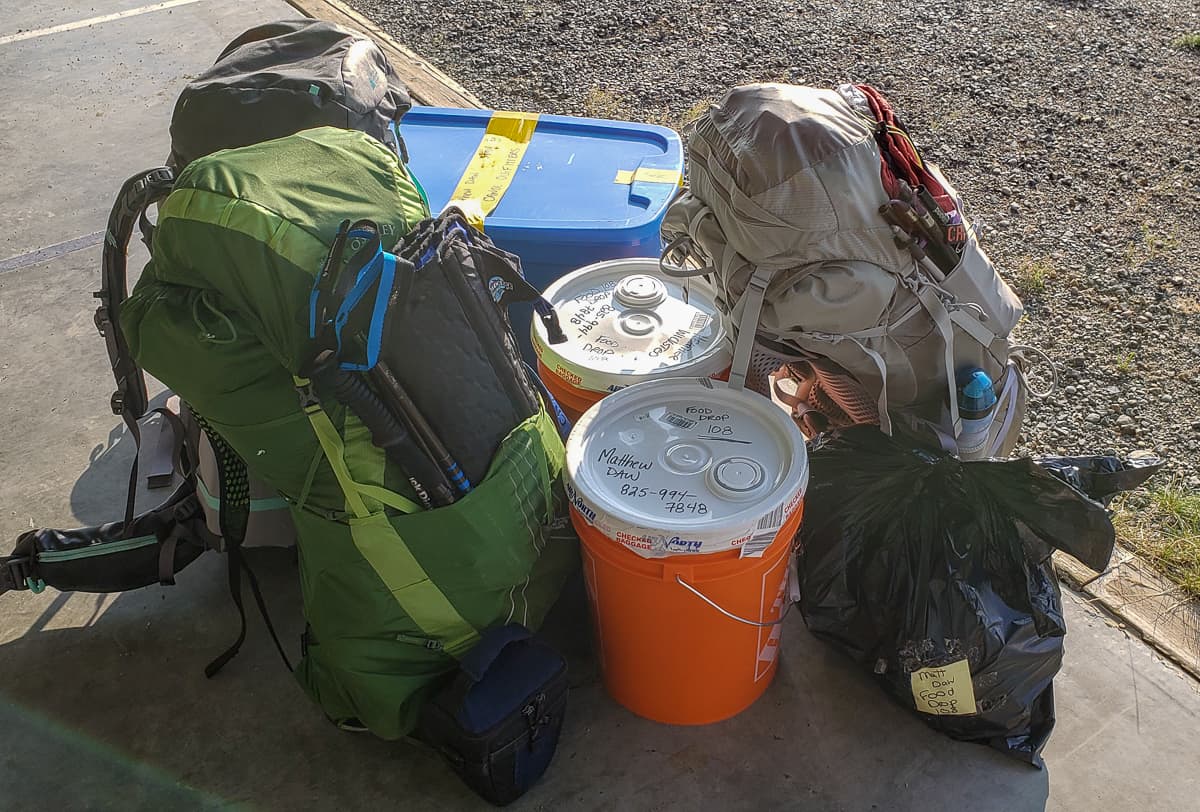
Our trip started in Whitehorse, Yukon where we purchased the last items of food and gear (bear spray, canister fuel) we would need. A chartered flight with Alpine Aviation from Whitehorse brought us to an airstrip at mile 222. This plane also dropped off our resupply at Canol Outfitters located at mile 160. The good folks at Canol brought our third resupply via helicopter to Mile 108 and left it in an abandoned truck – fortunately, we found it before the bears did. When we reached the Mackenzie River we sent a text to Sahtu Adventures and they brought us across the river to Norman Wells, NWT where we caught a regularly scheduled flight home.
Special Gear
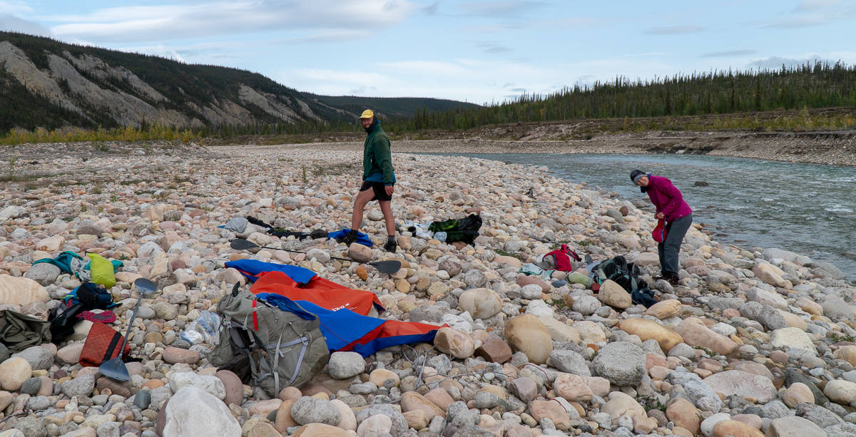
All the original bridges on the road have been washed away, so we had to figure out how to cross BIG deep, cold fast-flowing water. We each carried a Klymt Lightwater Dinghy and an Alpaca Rafting Ninja Paddle to get across the three or so rivers we encountered. This system worked really well and we were pleasantly surprised at how well the paddles worked given how light they were.
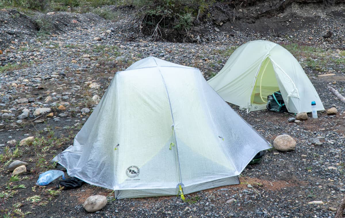
We knew our packs were going to be heavy so we were very excited to be supported by Big Agnes to use their top of the line ultralight tents. Specifically, we used the FlyCreek HV2 Platinum (1lb 10oz) and the Tigerwall 2 Carbon (1lb 6oz) tents. These tents were perfect – just enough room for 2 people in each but sturdy enough to handle snow, rain, and wind.
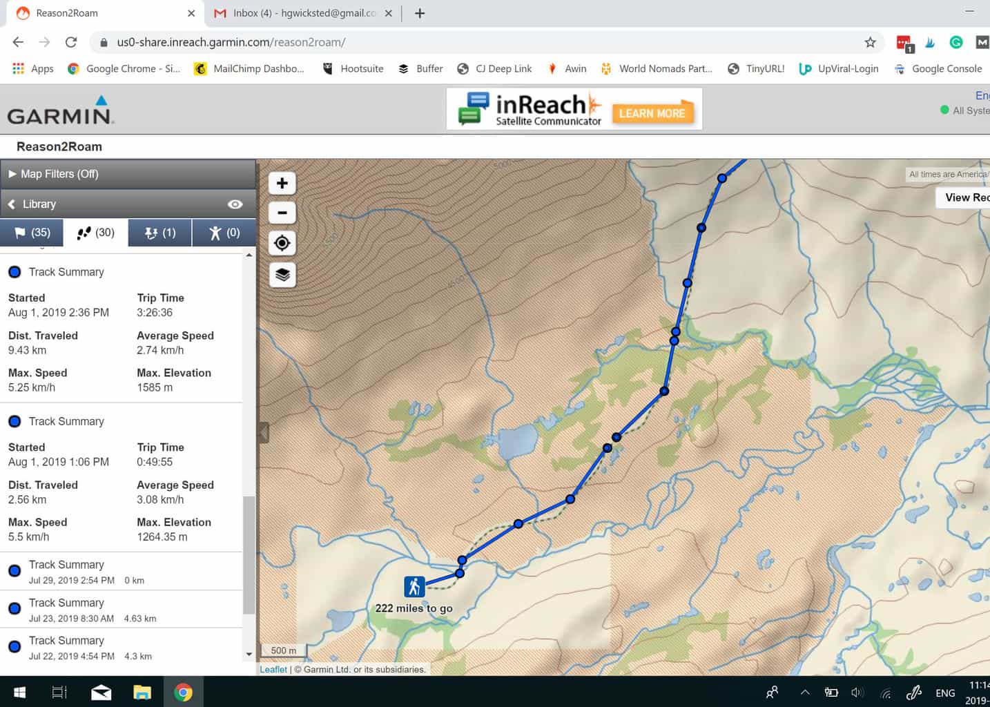
We used a Voltaic Arc 10 W Solar Charger to keep our electronics charged up. One of these electronics was our Inreach Mini. This small piece of amazing gear allowed us to send regular updates via text message to facebook and twitter. It was also our lifeline in the case of any emergency – fortunately we didn’t need to use the SOS button. Each night we set a waypoint for where we camped so our friends and family back home could keep track of us. You can see the map that was updated in real-time at the bottom of this post.
What Did We Eat?
If you asked Matt before the trip, his answer would have been TOO MUCH!
We carefully measured, planned and vacuum-sealed all of our food for 24 days (a few extra days for emergency purposes). Most of our food was purchased at Bulk Barn. We recreated a lot of the meals you see in outdoor stores, but by building them ourselves we were able to increase the protein and calorie content without adding a tonne of salt, sugar and ingredients we can’t pronounce! This system worked out perfectly.. we ate great food for all 22 days and really only got bored of the lunches (especially the one sleeve of crackers that got quite wet… it was a bit like chewing on wallpaper paste).
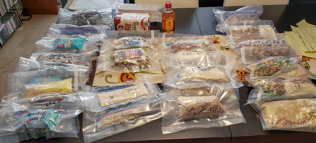
We carried 6 days of food from mile 222 to mile 160. We then loaded another 6 days of food and the packrafts and hiked to mile 108 where our second food drop was left. Our final leg (mile108-mile 0) was the heaviest as it contained 12 days worth of food.
The map
*This map really best on a desktop and it can take a while to load*
This map was updated every night with where we camped, and we also sent out little messages along the way too… like the time we saw that caribou or wolf.
The section on the left shows all the waypoints and info we have sent to the map. Look for a little arrow in the middle of the screen to collapse this section. The section on the right works like any other online map. Zoom in, zoom out and look for little icons like flags or small message boxes. Click on an icon and you will see more info!

Thanks for the Support
Planning a trip like this takes a lot of logistics and support from a lot of people like you! Just knowing there are people curious enough to even read this far is good for the soul! Specifically, we want to thank:
- Derek E and Heather E – for lending us Franklin and a great space to pack, and organize
- Rob P and Anne M – for airport rides, being an emergency contact, and just generally putting up with us!
- Chelsea P from NWT Tourism – for sending us the Maps and being so excited for our adventure
- Bob and Janet – the gift of the vacuum sealer made packing our food so much easier!
- Gail S – for the storage of our gear, lending us your car, and letting us get into your beer stash when we land at your house!